Its isolated location kept Mauritius from being settled until 1598 and even today, many people don’t know where it is. On a world map, it is an insignificant dot in that vast expanse of ocean between southern Africa and Australia, at longitude 57°E, latitude 20°S, overshadowed by its much larger neighbour, Madagascar, 855km to the west.
Africa is the nearest continent, with Mombasa some 1,800km away. Perth is 6,000km from Mauritius and London is 9,755km away.
Mauritius is part of the Mascarene Archipelago, together with its closest neighbour, the French island of Réunion (161km away), and its own territory, Rodrigues, which lies 560km to the east. The Cargados Garayos Archipelago, also known as the St Brandon Islands, 395km northeast of Mauritius, and the two Agalega Islands, 1,200km to the north, are Mauritian dependencies.
Mauritius also claims Tromelin Island, a French possession, and would like to reclaim the Six Islands, Peros Banhos, Salomon, Trois Frères and Diego Garcia, which have, since 1965, been the British Indian Ocean Territory (BIOT).
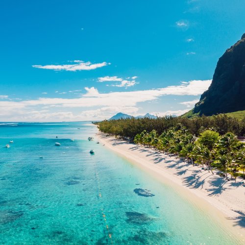
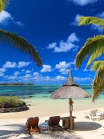
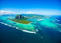
The island of Mauritius is 65km at its longest, and 45km across at its widest. There are 160km of coastline, almost entirely surrounded by coral reefs, while the centre is a great plateau punctuated by impressive mountains. The whole state, including its dependencies, has a land area of only 2,045km2, although, because the islands are so spread out, its sea area is vast.
Around Mauritius itself there are more than 15 islets lying in their own lagoons. North of the island, uninhabited except for wildlife, are six small islands: Serpent, Round, Flat, Gabriel, Amber and Coin de Mire.
The origins of the island of Mauritius date back some 13 million years, when masses of molten lava bubbled up beneath the ocean floor. It took five million years to surface through the activity of two volcanic craters. The weathered crater rims of these once enormous peaks still remain as the mountain ranges of Black River, Grand Port and Moka.
Further volcanic activity followed four million years later, opening up the craters of Trou aux Cerfs, Bassin Blanc and Kanaka. The island’s volcanoes have now been extinct for 200,000 years, although odd lava flows may have occurred up to 10,000 years ago.
The island’s rugged profile is a constant reminder of these cataclysms. The jagged volcanic peaks tower over coastal plains smothered in sugarcane, leaves waving like long green ribbons in the wind. The broad plain of the north rises to an extensive, fertile plateau, itself broken by more volcanic steeples and gorges. This tableland (600m/1,970ft high) is bordered by mountains which roll down to the crags of the southern coastline. In some areas there are deep, and seldom explored, lava caves.
It is not the height of the mountains that is impressive, but the sheer oddity of their shape. The highest is Piton de la Petite Rivière Noire at 828m (2,717ft). Pieter Both is next at 823m (2,699ft) with Pouce – the thumb-shaped mountain looming behind Port Louis – at 812m (2,664ft).
Despite the mountains and a rainfall on the windward slopes of the central plateau that can amount to 5m (197in) a year, Mauritius is not an island of great rivers. There are some 60 small rivers and streams, many degenerating as they reach the coast into rubbish-clogged trickles through cement ditches and culverts. The Grande Rivière Sud-est is the largest at 39.4km long.
The main harbour is at Port Louis, the capital, on the west coast. The airport is at the opposite side of the island, at Plaisance, not far from the old east coast harbour of Grand Port.
The island is divided into the same nine districts as it was when the British captured it in 1810. In a clockwise direction from the capital, these districts are Port Louis, Pamplemousses, Rivière du Rempart, Flacq, Grand Port, Savanne and Black River, with Plaines Wilhems and Moka in the centre. Rodrigues is a district in its own right.
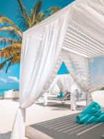
The eccentric terrain of Mauritius means that the island is blessed with a diversity of scenery not usually found in such a small area, and since there are good roads, travel is not time-consuming. When the brashness of the northwest coast is too much, sanctuary is easily found in the tranquillity of the southwest or the dramatic coastline of the south.


 100% Privacy Guaranteed